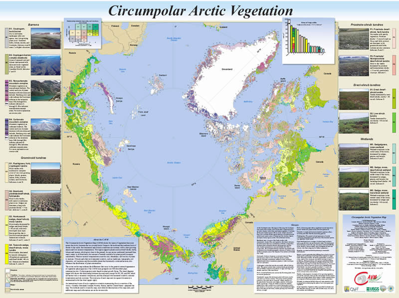
Circumpolar Arctic Vegetation Map (Published October 2003).
- Download printable map
- Download GIS data layers
- Metadata
Circumpolar Arctic Vegetation Map (Published October 2003).
False Color Infrared Image of the Circumpolar Arctic Tundra Region. (600x600 dpi, 57k)
Download data as a two band, 16-bit Imagine image. Display image as Band 2-1-1 to create CIR composite.
Maximum Normalized Difference Vegetation Index (NDVI) for the Circumpolar Arctic Tundra Region. (600x600 dpi, 76k)
Topography of the Circumpolar Arctic Tundra Region. (600x600 dpi, 49k)


